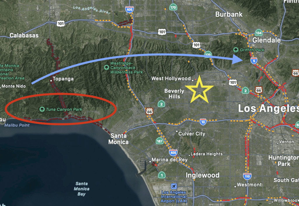
Where Are The Fires in Los Angeles

Where are the fires in Los Angeles, California? There’s no simple answer since it’s changing by the minute with our record-breaking Santa Ana winds. Currently, the worst hit area is Pacific Palisades (red oval on map) which stretches from the hills down to the coast. It is part of The Santa Monica Mountain Range (blue arrow). This range consists of some of Southern California’s most well-known neighborhoods. From the Pacific Ocean heading east we have Malibu, Pacific Palisades, Brentwood, Bel Air, Beverly Hills, West Hollywood, and the Hollywood Hills (gold star on map).
Other local fires include The Eaton Fire in Altadena which is just above Pasadena and about 30 minutes east of Hollywood, and The Hurst Fire in Sylmar. These are both in a different mountain range called The San Gabriel’s. We can typically expect fires this time of year because of drought conditions throughout the summer, and the strong wind gusts traveling through our many canyons. Sadly, we get the one-two punch when it eventually rains because the burnt-out areas turn to mudslides. Our heart goes out to everyone affected by these horrific disasters. The wind should die down within the next 10 hours, and we truly won’t know the scale of destruction until the smoke clears. Los Angeles is a MASSIVE city, but when catastrophes like these strike, it really does show how deeply we are all entwined as a community. Stay safe!
REQUEST YOUR TOUR
Sorry, we couldn't find any posts. Please try a different search.
